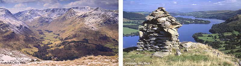
The High Street Fells

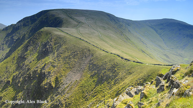
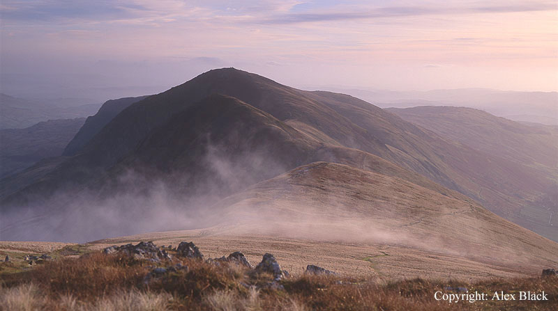
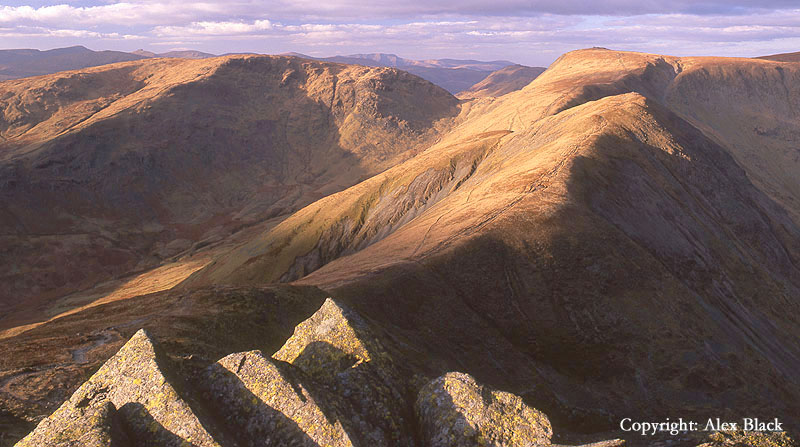
This area of fells rises to the east of Ambleside, the Kirkstone Pass and Ullswater, and includes the fells around Haweswater. Wainwright lists 36 fells here, almost all of which are part of a single system of ridges, which if followed to the highest point will bring you to the central fell of the group, High Street (828m). On the whole, the High Street fells tend to be long, lonely ridges, often wide and grassy across the tops, but with steep craggy sides; there is a grandeur here which is typically Lakeland, similar to Helvellyn and Fairfield but feeling a long way away from those busy, must-do fells of the central and western Lakes.
The geography of these hills was recognised very early on; Roman surveyors put in a road across High Street, connecting their fort at Ambleside to the one on the River Eamont at Penrith. The Romans famously always preferred a direct route, but the height and isolation also had the advantage of avoiding any chance of being ambushed. Traces of the road still survive, crossing the fell west of the summit; this is the origin of High Street’s name.
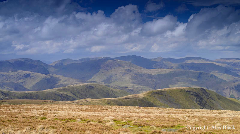
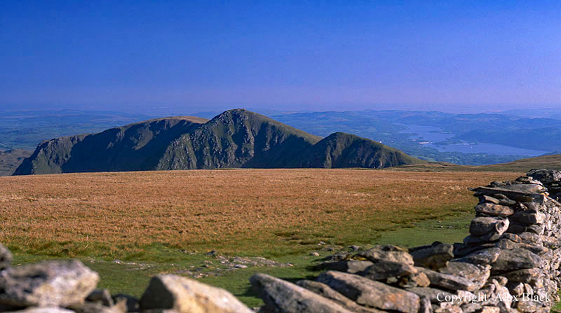
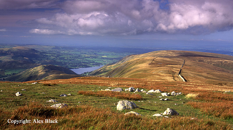
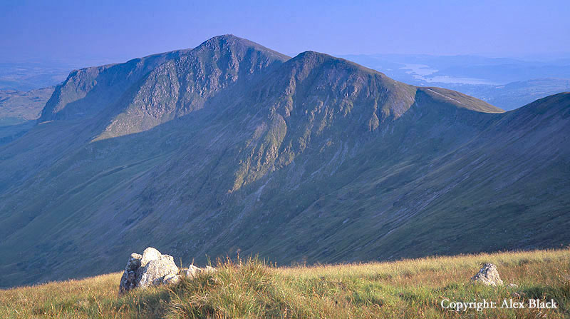
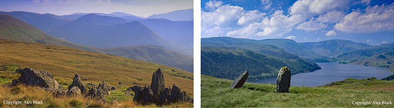
Wide, flat summits like High Street’s, rarely make for the best vantage points, and this is not helped by the wall here, although it is a very useful guide in bad weather. However most visitors will be surprised by how extensive the view is; Helvellyn and Fairfield are well seen across Patterdale, but the Coniston Fells, Bow Fell and the Scafells are also visible along with Blencathra and many of the Northern Fells. My favourite view here is from about 500m north of the trig-point, looking north to the Straights Of Riggindale; this is where the main ridge carrying the Roman road dips and narrows, then bears north-north-east towards Pooley Bridge at the foot of Ullswater.
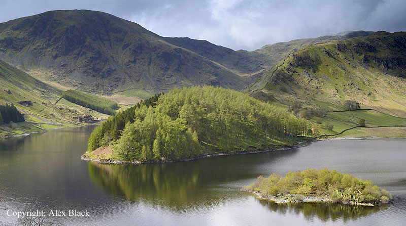
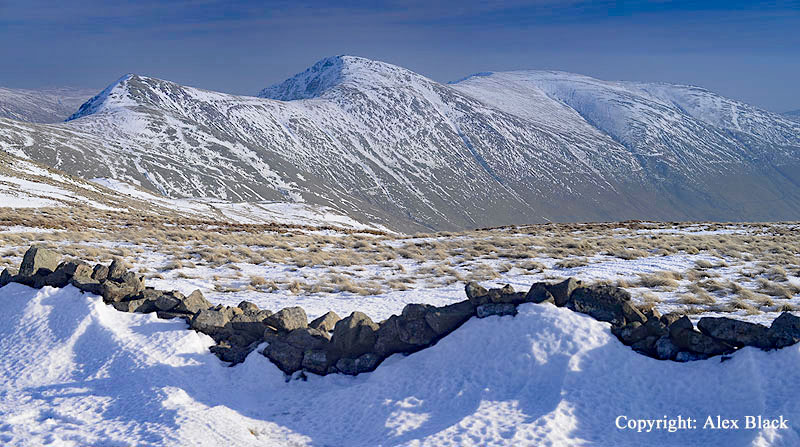
Perhaps High Street’s most dramatic feature is Blea Water, tucked in close below its eastern crags. The tarn is a near-perfect circle, sitting in a deep basin of crags; it was gouged out during the last Ice Age, making Blea Water the most perfect example of a corrie in the Lake District. Something very unusual must have been happening during its formation as the statistics are also impressive: at a depth of 63m (206ft) only Wast Water and Windermere are deeper waters in the Lake District.
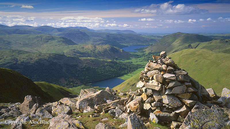
The simplest and most direct route up High Street is to ascend Rough Crag and Long Stile, which is a long, straight ridge on the eastern side of the fell. This ridge starts off as a wooded promontory at the head of Haweswater, called The Rigg. This is a lovely route; the ridge only being steep in its last 500m, with no narrow sections; there are good views all the way, especially of Blea Water and its crags. The popular return route is to turn south over Mardale Ill Bell (760m) and descend to Nan Bield Pass where another tarn, Small Water, is passed on the way back down to Haweswater. Total distance approximately 9.5km (6 miles).
Although Haweswater is definitely worth visiting, Hartsop in Patterdale is a more convenient starting point. This route passes by Hayeswater and The Knott (739m) then crosses the Straights Of Riggindale at the north end of High Street. Wainwright gives this route as 6km (3 ¾ miles) each way.

If a longer route is wanted, taking in more summits it is possible to do a horseshoe from Hartsop. Take the path up to the reservoir, but just before reaching the dam turn off to the right to ascend the north ridge of Gray Crag (698m); the best view is from the top of the ridge, looking down on Hartsop and across Patterdale to Helvellyn. From the summit, a grassy ridge rises gently southwards to Thornthwaite Crag (784m).
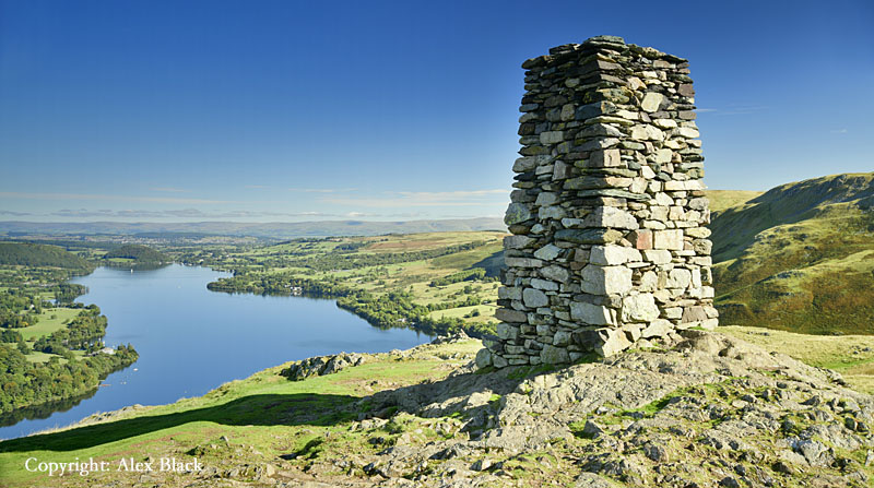
This is one of the most distinctive of all Lakeland Fells having a tall well-built cairn on the summit, Thornthwaite Beacon. As the 4th highest of the High Street fells with a good position in the group, it has excellent views to the south and west; the view of Windermere is particularly striking. The route for High Street curves east then north on a clear path around the head of Hayeswater Gill, joining the Roman road as it climbs onto the side of High Street. The Roman Road skirts the western edge of High Street, heading directly for the Straights Of Riggindale, but missing out High Street’s summit; to get the best views, bear right off the path to cross about 100m of moorland to the wall, where the summit is marked by a trig-point. To continue the route, follow the wall north to the Straights of Riggindale, and the descent to Hartsop. Approximate distance for this route: 16km (10 miles).

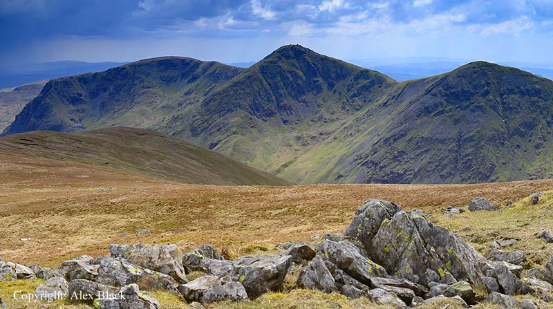
Just north and east of the Straights Of Riggindale the high ground of the range continues with a cluster of 3 high fells. Closest to The Straights Of Riggindale is Rampsgill Head (792m), third highest of the High Street fells; this is my favourite of the three with an impressive view over The Straights to High Street, and a wide-ranging view west over Patterdale to Helvellyn and Blencathra.
Next heading north-east along the Roman road is High Raise; at 802m this is second only to High Street in the Far Eastern Fells. The Roman road passes just west of the summit where there is a fine cairn, and the views west are also good here. But looking north-east along the main ridge of the Roman road, the wide open spaces of these fells are impressive. The third summit in this cluster is Kidsty Pike (780m), the 5th highest in the group. This is one of the best summits in the Far Eastern Fells; a neat, rocky peak poised above the deep valley of Riggindale. Together these summits form a neat triangle, a visit to all three is about 3km (2 miles) and can be added to either of the above walks.
The most famous Horseshoe walk on the High Street Fells is the Kentmere Horseshoe (21km or 13 miles). Kentmere is a long valley north of Staveley near Kendal, where there is a small carpark near the church. Following the walk in an anti-clockwise direction, the route starts by heading east on the bridleway over to Longsleddale; at the top of the pass turn north where a wall can be followed up to the first summit, the rocky top of Shipman Knotts (587m) where the views are already taking in the Coniston Fells. The wall continues north-west and can be followed over the top of Goat Scar to the next summit, Kentmere Pike (730m).

The wall here is something of an obstacle, but the views west, of and over the Ill Bell ridge, have opened up to include the Scafells. The wall can be followed onto the next summit, Harter Fell (778m), the sixth highest in the Far Eastern Fells. The summit cairn stands above the ridge down to Nan Bield Pass; there are good views in most directions here, but to see Harter Fell’s most famous view you need to continue on past the summit cairn to the north-east cairn which stands above its main crags, giving an aerial view down on Haweswater.

Descend to Nan Bield Pass, cross the pass and ascend to Mardale Ill Bell (760m); although this is little more than a shoulder of High Street, the summit has a few rocky outcrops and a fine cairn, and a good view of Haweswater.
Astonishingly, many guides listing this route miss out a visit to the summit of High Street, preferring to skirt around the head of Kentmere, but to head onto High Street there is a good path heading north-west to the summit wall, turning right at the wall, up to the trig-point.
The return leg of the Kentmere Horseshoe follows the wall south-south-west from the summit of High Street, then curving west to the tall, well-built cairn on the summit of Thornthwaite Crag (784m).

The route then turns south with the next 3 km (2 miles) being the best section of walking in these fells. A clear path leads down the ridge to Froswick (720m) then Ill Bell (757m).
This is one of the best summits of the Far Eastern Fells, being small and rocky, crowned with a well-built cairn. South of Ill Bell the ridge widens to Yoke (706m) then continues on to the Garburn Pass; when Garburn Pass is reached, turn left to return to Kentmere.
Standing to the east of the Kirkstone Pass is Caudale Moor (763m; summit named Stony Cove Pike). This is a wide, sprawling fell sending ridges north and south, and connecting with Thornthwaite Crag by the rocky pass of Threshthwaite Mouth. The summit can be gained fairly easily from Kirkstone, but always seems to take longer than it should; Wainwright gives this as 4km (2.5 miles). The best view here is from the top of the north-west ridge, looking down on Brothers Water, Patterdale and Ullswater.
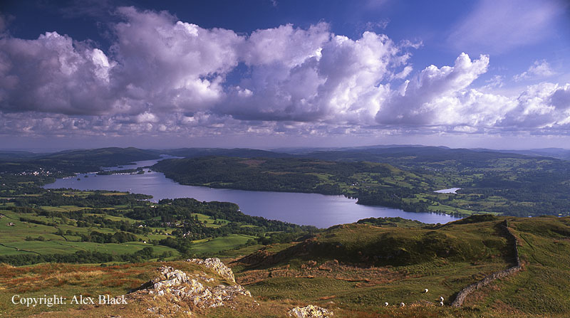
Many of the Far Eastern Fells are quiet, lonely places, but there are a couple of fells which have become favourites, one of these is Wansfell (487m). The summit is a grassy, undulating ridge about 1.5km long, the south-western end of which is a prominent, rocky viewpoint overlooking Ambleside and Windermere; this is Wansfell Pike (482m).
The popular walk here starts from Ambleside, past Stockghyll Force and up to the Pike on a clear path. The true summit of the fell can be reached by following the wall NE, but the Pike has by far the best of the views, so most people bear east to Troutbeck by Nanny Lane. The return route to Ambleside is by Robin Lane which crosses the lower slopes of the fell to arrive at Waterhead via Jenkin Crag.

In the north-western corner of the Far Eastern Fells, Place Fell (657m) holds a similar status. Place Fell stands in a prime location, rising steeply above the head of Ullswater, opposite Glenridding, giving it good views in almost every direction. As a whole, the fell covers a considerable area, occupying about 4km of the shores of Ullswater; there are several subsidiary summits and rocky outcrops, and the lakeshore path is one of the most famous in The Lakes. Place Fell is almost worth a day’s exploration in itself. Most walkers ascend Place Fell from Patterdale via Boredale Hause, then from the summit there are a couple of paths heading north-east to join the lakeshore path at Sandwick, for the return route to Patterdale.
Boredale Hause also gives access to Angle Tarn and the nearby rocky summits, Angletarn Pikes (567m); there are good views here looking across Patterdale to Helvellyn, and towards High Street. Arguably, it is the tarn which is the main attraction here, being a popular short walk from Patterdale, although the main path here continues on to High Street. A little further on from Angle Tarn the path crosses Satura Crag which has its own attractive little pool.

The north end of the main ridge of High Street which carries the Roman road descends towards Pooley Bridge at the foot of Ullswater. North of High Raise, Wainwright lists 4 summits on the ridge: Wether Hill (670m), Loadpot Hill (672m), Bonscale Pike (524m) and Arthur’s Pike (532m). These last two are the best viewpoints, perched above the foot of the lake with some interesting cairns on the edge of the crags.
Tucked in below this ridge is Hallin Fell (388m) which occupies a good position on the shore of Ullswater. This is a favourite fell for many walkers of all ages as it can be climbed easily from The Hause, often known as Martindale Hause. The summit is marked by an impressive cairn and there are lovely views of Ullswater, and south into the peaceful valley of Martindale.

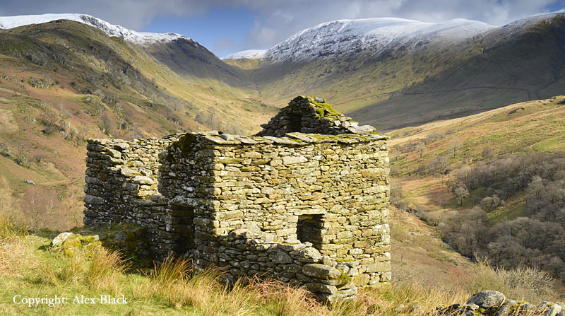
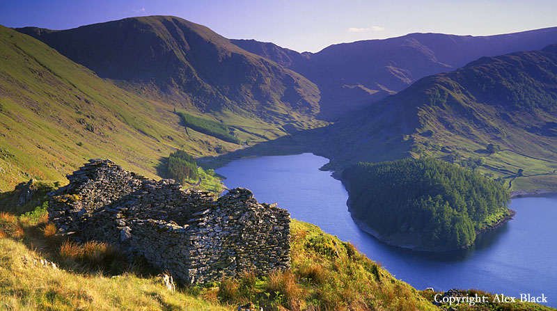
I have to admit that I am rather fond of many of the quieter, out-of-the-way fells in Lakeland, and there are two fells east of the head of Haweswater which can be done as a short loop. The route starts along the Old Corpse Road to Swindale, where there are some ruins with views over the head of the lake.
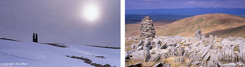
At the top of the track turn right onto Selside Pike (655m); the summit is a simple grassy dome with a sprawling cairn, which is probably Bronze Age in origin. A fence also crosses the summit here: the route follows the fence south-west, crossing some boggy ground. Before reaching the next summit, look out for the small tower on the left; this is a survey column used during the construction of the pipeline from Haweswater.
The fence leads up onto Branstree (713m), but before reaching the summit there is a rocky area with an attractive cairn just to the right of the path; this is Artle Crag. Branstree is not the best fell for views but 100m north of the summit there is a good view of Haweswater, and the crags of Harter Fell appear impressive from here. To continue the route, follow the fence south-west down to Gatescarth Pass: from there turn right to return to the head of Haweswater. Alternatively, if there is time, it is a fairly simple walk to carry on to Harter Fell where there are much better views.