Grasmoor and the Newlands Fells

This area of fells rises to the west and south-west of Keswick and covers the area as far as Buttermere, Crummock Water and the Lorton Valley. It is crossed by two roads which neatly divides the area into three; the northern end is crossed by the Whinlatter Pass, and south-west of Keswick is the Newlands Pass. The fells in each of these three areas form separate groups, the largest of the three groups with the highest fells is the one in the middle between the two roads: this is the Grasmoor group of fells.
Grasmoor Fells
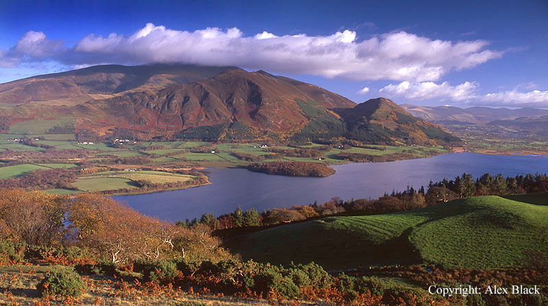
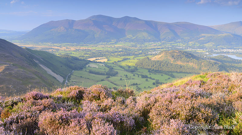
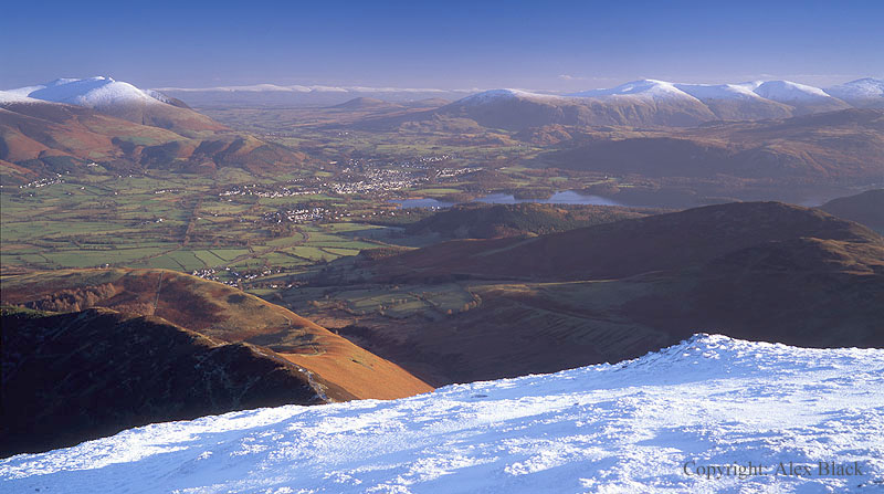
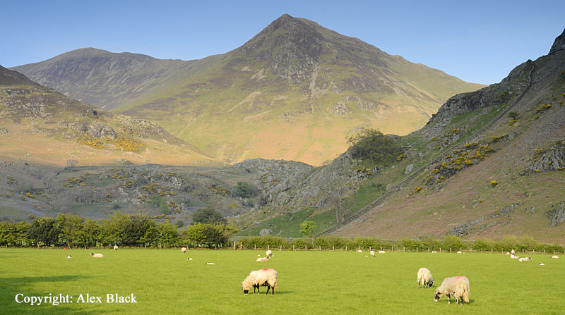
The highest fell in the North Western Fells is Grasmoor (852m). This is a bulky fell rising steeply above the north end of Crummock Water in an impressive tumble of crags. The main crag here is Grasmoor End which, seen from some angles appears to rise to a point; this is an excellent viewpoint over Crummock Water, but the summit of the fell is about 700m east. Grasmoor’s summit is almost a plateau, running east to west for almost 1.5km, and is more than 200m wide in some places. The main path to the summit runs across the south side of the ridge, above the southern flank, and the best views are from here, looking south over Buttermere to Great Gable and the Scafells. But there are good views in all directions; as such a high viewpoint almost areas of the Lake District are in view except for the Far Eastern Fells.

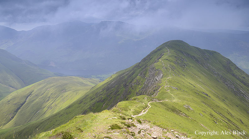
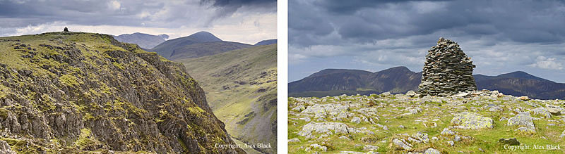
In spite of its size and height, Grasmoor is not the geographical centre of the North Western Fells, this is its neighbour Crag Hill (839m) which is about 1.5km east across a wide grassy saddle. Crag Hill is the name given on maps but known to Wainwright as Eel Crag. This is the second highest point in the North Western Fells, and the place where all the ridges connect to. Although significantly lower than Grasmoor, it has a smaller, neater summit; many of the views are arguably better from here, particularly to the east, and perhaps significantly, this is where the Ordnance Survey chose to site their survey column. The name Eel Crags refers to the rim of crags north of the summit, overlooking the long Coledale valley, which are some of the best crags in the area. There are ridges connecting to the north, south, east and west (to Grasmoor); for walkers who like rocky ridges, the best ridge here is to the east, starting on Causey Pike.
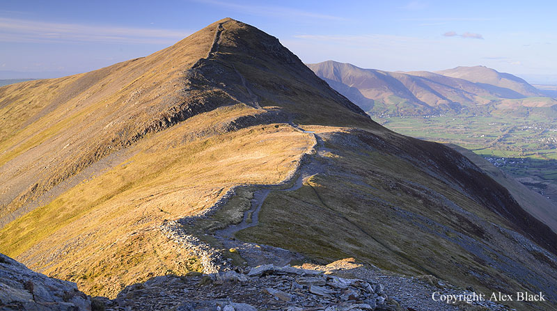
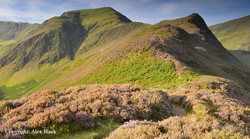
Causey Pike (637m) is one of the most distinctive fells in the area; rising steeply from the fields of the Newlands Valley south-west of Keswick, it is a conspicuous fell from the north-eastern shores of Derwent Water at Crow Park and Friar’s Crag. Its distinctive outlines are capped by a distinctive summit; a domed turret crowns the steepest, narrowest part of the ridge, which is then followed by a series of crinkles. Three routes of ascent start from Stoneycroft: the direct route and main path slants up the side of Rowling End (Causey Pike’s long eastern ridge) to the steeper section of the ascent, with the final section being a rough gully.
The alternative over Rowling End is a trickier route, the first section being much steeper and less clear, but the benefit is that in late summer, once the ridge has been gained, the heather here is wonderful. The third route from Stoneycroft is the easiest: follow the track up beside the beck for about 2.25km to High Moss. Look out here for a new path off to the left which gently curves up onto the west end of the summit. The view from the top is excellent, the only disappointment is that there is less of Derwent Water to be seen than would be imagined.

The next summit on the ridge is Scar Crags (672m). This is little more than a connecting ridge onto the next fell, although it is narrow enough to make the walk interesting and has nice views back over Causey Pike. At the western end of Scar Crags, the ridge is crossed by Sail Pass (610m) which is a high-level footpath from Braithwaite to Buttermere.
From Scar Crags, the next fell Sail (773m) looks extremely dull, a wide grassy hill with a wide path cut directly up it, but west of the summit the fell narrows, and there is an excellent ridge ascending to Crag Hill.
Running almost parallel to Causey Pike and Scar Crags are alternative routes onto Crag Hill from Braithwaite. The direct route is via Barrow Door and Sail Pass, but there are two Wainwright summits which are close to this route.

The first is Barrow (455m). The route to the summit from Braithwaite is a steady walk; there are nice views over the Newlands valley, although again, the view of Derwent Water is disappointing.
From Barrow, there is an easy path connecting to the Stoneycroft to Sail Pass track, and after just over 1km, the summit of Outerside (568m) can be climbed. Outerside is set back into a circle of higher fells giving it intimate views of the head of Coldale, and this is a lovely spot particularly when the heather is in bloom.
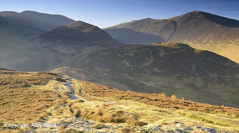
North of Crag Hill, across the head of Coledale (Coledale Hause) a separate ridge of three fells runs runs east-west from Braithwaite towards the foot of Crummock Water.
Starting from Braithwaite, the first fell is Grisedale Pike (791m); this is a prominent peak in the skyline west of Keswick, the summit having a distinctive, pyramid appearance.
There are several routes up Grisedale Pike from the Whinlatter Pass road, the one which starts from just above Braithwaite, ascending by Kinn and Sleet How, is the best starting for anyone returning by Coledale, or doing the Coledale Horseshoe.

Being in such a good position, the summit has excellent views in most directions, particularly looking west to the head of Coledale, and along the ridge to the next fell, Hopegill Head.

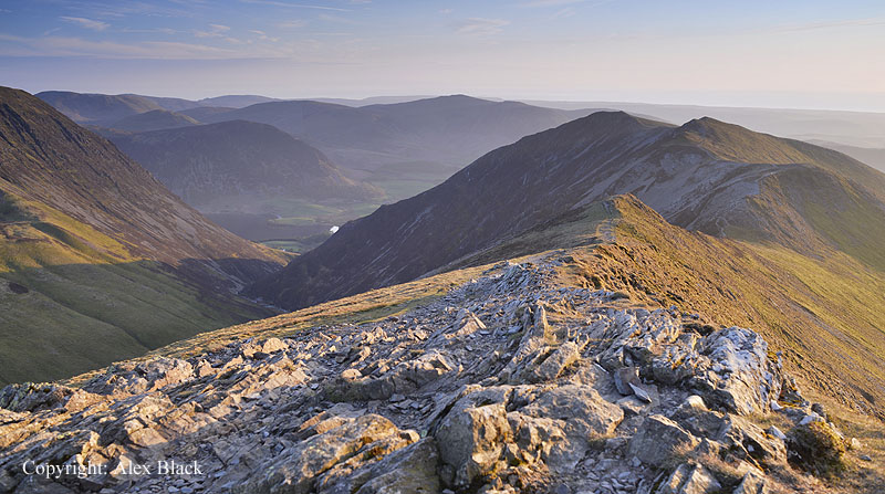
Hopegill Head (770m) is one of the best summits in the North Western Fells, where a small rocky outcrop sits above crags to the north and east. To the south there is a subsidiary summit, Sand Hill, which connects this ridge to Coledale Hause and Crag Hill. There is also a substantial ridge to the north which is an excellent route up from Lorton; this route crosses Ladyside Pike followed by a rocky ridge to the summit.
Although lower than Grisedale Pike, the views are still good, and the head of the Hobcarton valley to the north-east is particularly impressive.
Following the ridge west, the next fell is Whiteside (707m). This is a ridge which runs for about 1.2km with many little ups and downs; the highest point on the fell is actually about half-way along the ridge at 719m, but the recognised summit is at the western end which has the better views of lakes and valleys.
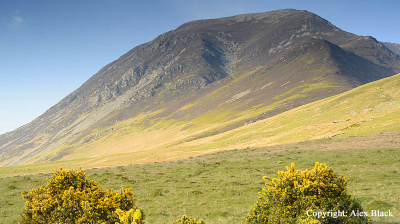
This western end of Whiteside descends steeply towards Crummock Water, and to the north easier ridges descend towards Lorton, but Whiteside’s most dramatic feature is its southern face, where broken, slatey crags fall steeply to Gasgale Gill, a deep ravine tucked in between Whiteside and Grasmoor.
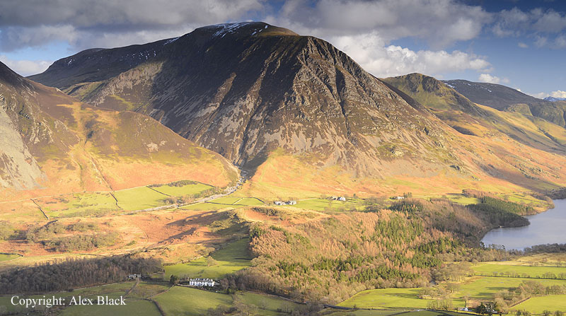
South of Crag Hill, a ridge descends to Buttermere which is an excellent route up into the high North Western Fells. This starts at the west end of the village near the National Trust carpark and crosses an area of open hillside to Whiteless Breast, then onto Whiteless Pike (660m). This is a neat, little summit which gives the fell a classic pyramid appearance from some angles, although it is really just the end of a ridge.
This ridge, Whiteless Edge, leads on and up to the higher fells of the group. At the top of the ridge the main path bears straight on, then left for Grasmoor, but bearing right brings you to Wandope (772m) which sits just below Crag Hill, and is a nice summit with good views in its own right.

This starting point at Buttermere can also be used for Rannerdale Knotts (355m) which is a lovely little hill boasting excellent views of Buttermere and Crummock Water. After crossing the open hillside mentioned above, bear left before the steeper ascent of Whiteless Breast. This brings you onto a grassy ridge (named Low Bank on OS maps) which steadily narrows with rocky outcrops, then suddenly finishes with a bird’s eye view over Crummock Water.

Looking backwards, there is also an impressive view of Buttermere, tucked in below the many high fells surrounding the head of the valley. For many visitors to the Lake District, Rannerdale is more famous as the valley at the foot of the fell which has a wonderful display of bluebells in May.

The Newlands Fells
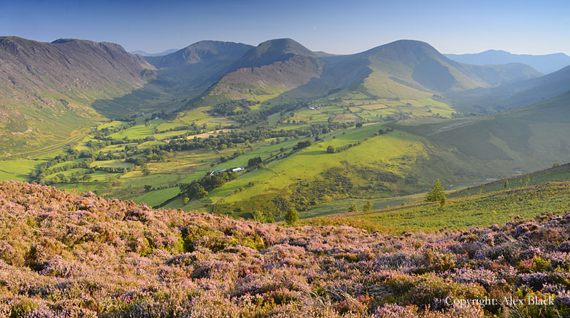
The Newlands Valley south-west of Keswick might lack a lake, but more than makes up for this with its fells. Wainwright lists 7 fells between the Newlands Pass and the Borrowdale-Honister road; one of which is amongst the most famous in The Lakes…
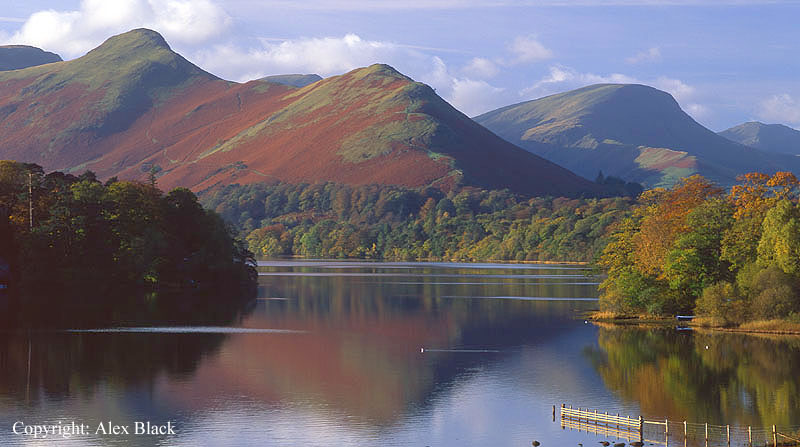
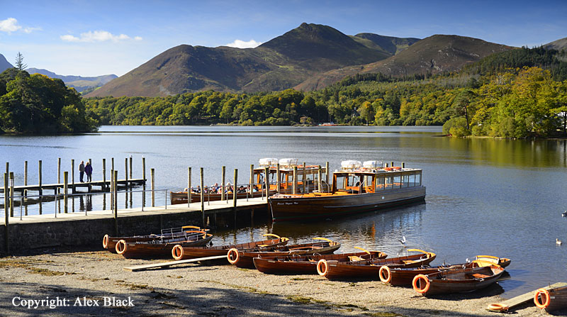
Catbells (451m) is a fell known to almost everyone who visits Derwent Water, and its distinctive outlines appeal to anyone who sets eyes upon it.
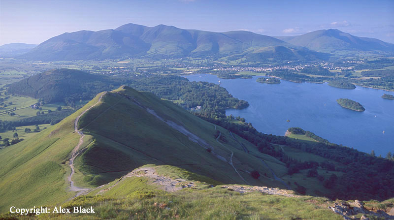
The path up its north ridge is clear to see, but should not be under-estimated; Catbells is a miniature mountain and this route is steeper, rougher and narrower than a first-time fell-walker would expect. The summit does not disappoint being small with excellent views over Derwent Water, Bassenthwaite Lake and Newlands, with a peep into Borrowdale.

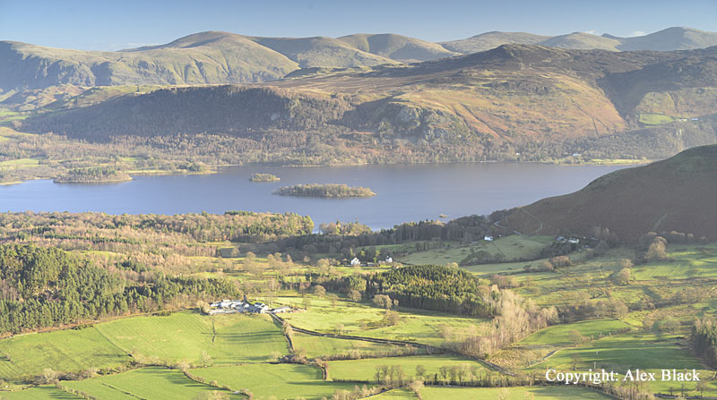
To the south, Catbells connects with the other Newlands Fells, making it is possible to cover the six high fells in this group in one ridge-walk; this is the Newlands Horseshoe. Following the ridge south of Catbells the first is Maiden Moor (576m). This fell is little more than a link on the way to the highest point on this ridge, and although this summit is rather less interesting, the views are at least as good as from Catbells.
Continuing south, the route goes along an easy ridge which is full of interest. After about 1km it is worth taking the short diversion to the top of Blea Crag; the summit of this fell is about 1km further on; this is High Spy (653m). The summit here is rockier and is topped by a distinctive, well-built cairn. Sadly, the views of Derwent Water have been left behind, but the views south are now fully revealed, showing the fells at the head of Borrowdale: Bowfell, Glaramara, the Scafells and Great Gable.
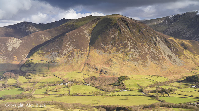
To the south-west the view is dominated by Dale Head (753m), the next fell on the Horseshoe. The route continues south, descending to Dalehead Tarn, then turns right up a wide grassy slope to Dale Head’s summit. This is the highest point on the Newlands Fells, and the summit here is also marked by a well-built cairn.

There are excellent views in every direction, but particularly looking north down the length of the Newlands Valley to Skiddaw. Dale Head can be climbed directly from Honister Pass; an excellent, easy short walk to one of Lakeland’s higher summits.

The Newlands Horseshoe route has now turned west, and an easy ridge connects to Hindscarth (727m). The summit lies about 500m north, off the route of the horseshoe, with the best view (looking down Newlands) being another 200m further on at the north cairn.
The summit is rather flat and does not do justice to the fell; its best feature is really its north ridge (Scope End), coming up from Little Town church. This is a lovely route of ascent, particularly in late summer when the heather is out, but is often used as a descent if the full horseshoe is not being done.

To continue with the horseshoe, turn back south from the summit for about 500m, then turn right onto Littledale Edge which curves north onto Robinson (737m). The summit has a few rocky outcrops, and there is similar view as from Hindscarth, except that Crummock Water and Loweswater have now come into view. To complete the horseshoe, bear north-north-east from the summit cairn and descend the High Snab Bank ridge to Newlands Church.
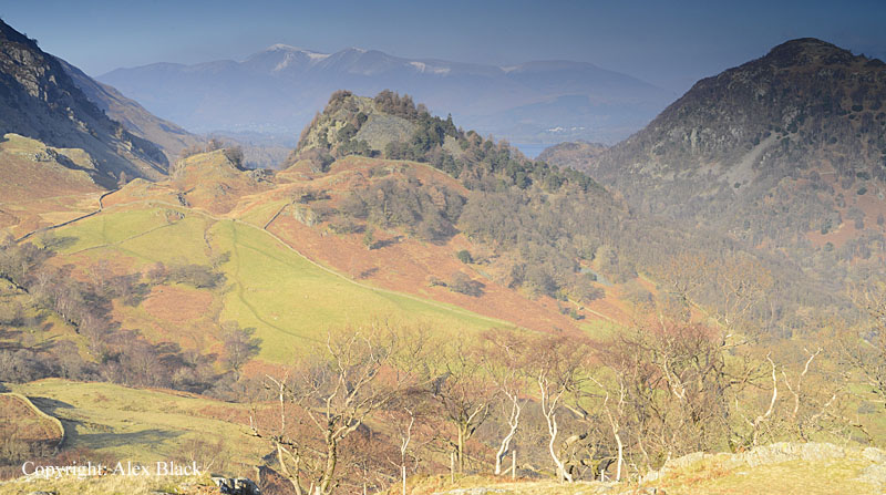
The last fell Wainwright lists in this area is Castle Crag (290m), which is a rocky outcrop rising on the eastern slopes of High Spy. This is the lowest of the 214 fells listed by Wainwright, the only one below 1,000ft, but it seems to have been included partly because of its rockiness and because of excellent position in the “Jaws of Borrowdale”. Castle Crag does not have any ridges connecting it with other fells so it is usually climbed on its own, and is now-a-days a popular fell. The key to climbing Castle Crag is the is the old pack-horse track between Seatoller and Grange; from here the final 120m of ascent is steep and rough, climbing up through the spoil-heaps of the old slate quarries, the remains of which can be seen all the way up to the summit. The view is in two parts: looking north there is an excellent view of Derwent Water and Skiddaw, and to the south the Borrowdale valley is spread out below.

The Whinlatter Fells
North of the Whinlatter Pass is a group of 7 fells which sit on the edge of the Lake District. For the most part, these are more in the character of hills and moorland, very different to the mountainous landscape south of Whinlatter. The highest point is Lord’s Seat (552m) which stands above the forestry plantations of Whinlatter; on its edge are the crags of Barf (468m) which rise steeply above the head of Bassenthwaite Lake. The four fells north of Lord’s Seat tend to be grassy hills; my own favourite here is Sale Fell (359m) which can be easily climbed from Wythop Mill. The eastern end of the fell suddenly reveals a wonderful view of Skiddaw and Bassenthwaite Lake.