Scafell Pike, Bowfell and the Coniston Fells

At its southern end, this area of fells rises with the Coniston Fells, then running north with Langdale as its eastern boundary, it continues over into Borrowdale as far as Stonethwaite. Wasdale and Seathwaite in Borrowdale form the boundary on the group’s north-western side, but the south-western boundary is less well defined. Having covered all the high fells around the heads of the Eskdale and Duddon valleys, a long ridge continues south-west, but here Wainwright draws a line to exclude the lower, less-rocky fells south of the Birker Fell. The group is crossed by road at the Wrynose and Hardknott Passes; the Wrynose Pass neatly divides the Coniston Fells from the rest of the group. There are 30 Wainwright fells in this area, 9 of which are in the Coniston Fells.
The Scafells
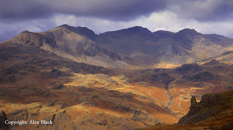
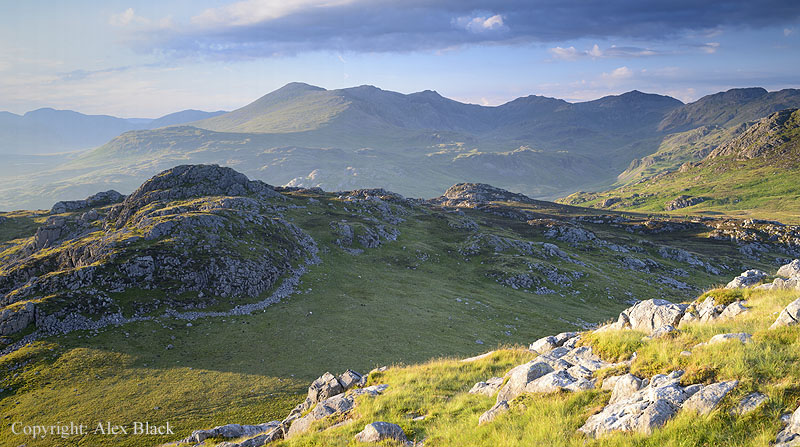
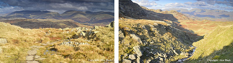
The Southern Fells include England’s highest mountains. I feel justified in calling these mountains, not simply because of the height, but because of the crags and rocks across the higher fells; this is very rough terrain, typical of mountain form.
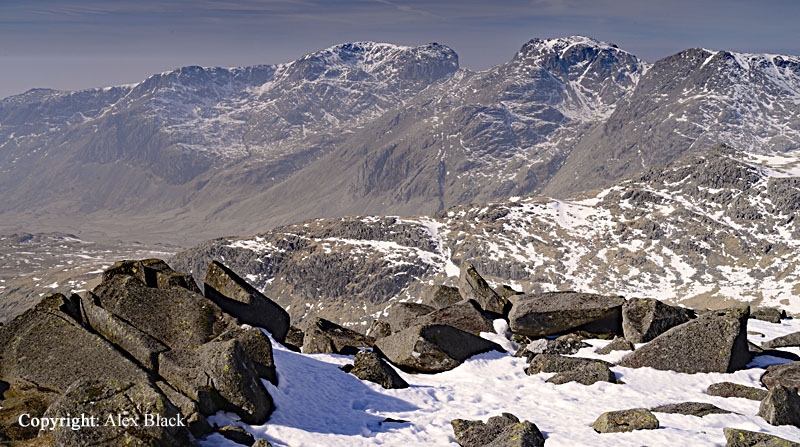
At 978m, Scafell Pike is the highest point in England. Like most Lakeland fells, Scafell Pike does not stand alone but is the highest point on a ridge of high fells which stretches from Eskdale to Borrowdale, maintaining a height of 600m for about 6km (or about 2,000ft in height for almost 4 miles). From south to north the summits in this ridge are: Slight Side (762m), Scafell (964m), Scafell Pike (978m), Broad Crag (940m approx.), Ill Crag (935m), Great End (910m) and Seathwaite Fell (601m). Not all of these are “Wainwright Fells”; being so close to Scafell Pike, Broad Crag and Ill Crag are usually taken as being part that fell as they would never be climbed for their own sake.
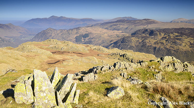
The view from the summit of Scafell Pike is impressive, there is interest in every direction, with almost all areas of the Lakeland fells in the view. For me, the best bit of the panorama is the northern quarter; Great Gable looks particularly dramatic with the other western fells beyond, and there is a glimpse of Derwent Water backed by Skiddaw and Blencathra.
Perhaps the only disappointment is that none of the lakes are clearly seen; there is a glimpse of Windermere to the south-east, and only a small strip of Wast Water can be seen from the summit. However, being close to the coast other areas can also be seen in clear in weather: the Isle of Man can often be seen out to the west, and South-West Scotland is sometimes visible between north and north-west. I have just once seen Snowdonia in north Wales from here, appearing to the south-south-west, directly over Black Combe. In theory, Ireland should also be visible out to the west, but only in the very clearest weather.
As with many of Lakeland’s highest fells, the summit is surprisingly wide, but gently rises to a clearly defined summit, perhaps more clearly than most as a viewing platform has been built here next to the trig-point. The summit is rough and rocky almost everywhere making walking difficult except on the main paths, but it is worth visiting some of the edges to make the most of the views. Just 100m north-west of the summit is the top of Dropping Crag which has the best view of Great Gable and Borrowdale. About 250m south of the summit is Scafell Pike’s South Peak which is a natural mound of rock with a bird’s-eye view of Eskdale. Scafell Pike’s most famous crag is Pikes Crag; this is about 500m west of the summit, not too far from the main path down to Wasdale Head. The crag stretches for about 500m and about half-way along is the distinctive buttress of Pulpit Rock.

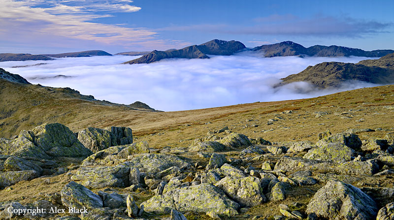
As England’s highest mountain, Scafell Pike is one of those must-do walks. The main routes up are well covered in a wide range of walking books (Wainwright’s included), but there are a couple of things worth mentioning. The shortest way up is from Wasdale Head by Hollow Stones, but anyone who has a little bit more time could go via Lingmell (800m approx.) using its west ridge. The views on this route are much better, particularly over Wast Water on the way up, and then of Great Gable and Styhead from the summit. However, the best route is from the south by Eskdale, this is one of the longer routes, approximately 8km (5 miles) from Brotherilkeld at the foot of Hardknott Pass. The upper Eskdale valley is perhaps the one true mountain fastness in the Lakes, one of its few truly wild places.

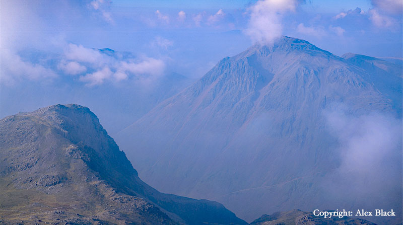
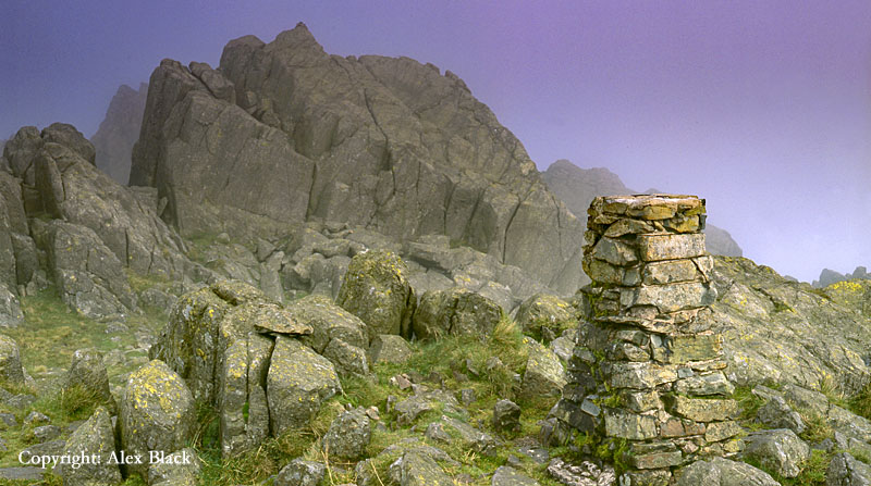
Just over 1km south-west of Scafell Pike is Scafell (964m), England’s second highest mountain. At such a short distance it will be assumed that taking in both fells would be a simple thing, but the route between the two fells is the most difficult in the Lake District.
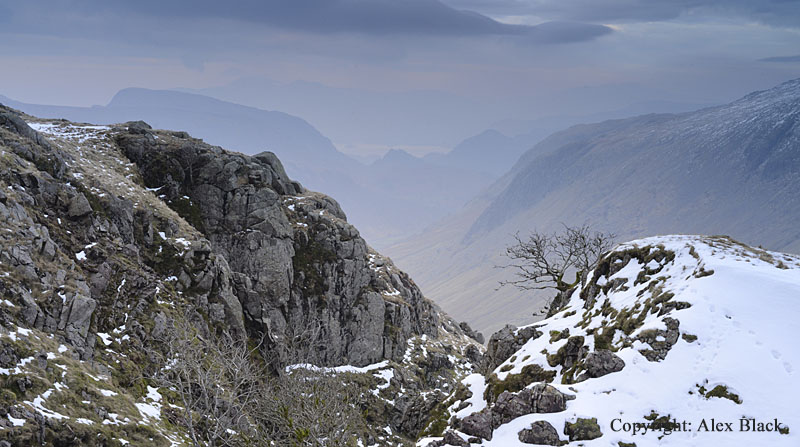
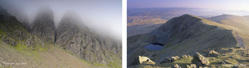
The first 700m or so is a fairly simple walk down to the connecting ridge of Mickledore, but at this point the massive crags of Scafell straddle the ridge forcing a diversion away from a direct line of approach. Wainwright gives a complete list of the many options; I have usually opted for the longer route by Foxes Tarn even though this involves a considerable descent and a rough re-ascent it is less exposed than the Lord’s Rake route.
At just 14m shorter than Scafell Pike, the view from Scafell is almost as good except to the north-east where the higher fell hides the view towards Helvellyn. The summit is a low platform of rock bearing a modest cairn; 250m south, at the top of the south ridge, there is a fine view down the ridge into Eskdale. But the best views are from 250m north across a stony saddle.
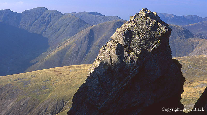
This brings you to one of the most spectacular places in the Lakeland Fells; the top of Scafell Crag. The view from here looking north is probably the best mountain view in the Lakes, with the pinnacles of Scafell Crag in the foreground, the view takes in Great Gable and Pikes Crag on Scafell Pike. Besides Scafell Crag, the best side of Scafell is its eastern side, rising above Eskdale, and as with Scafell Pike this is the best route of ascent (then descend by the south ridge).
By contrast, the western flank is a huge sweep of almost featureless fellside; tedious as this is, it does give a safe route on and off the fell from Wasdale Head, the shortest route.
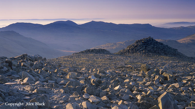
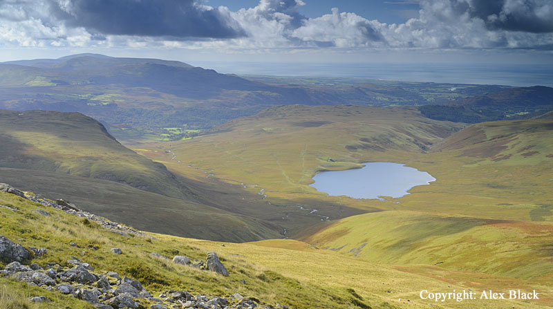
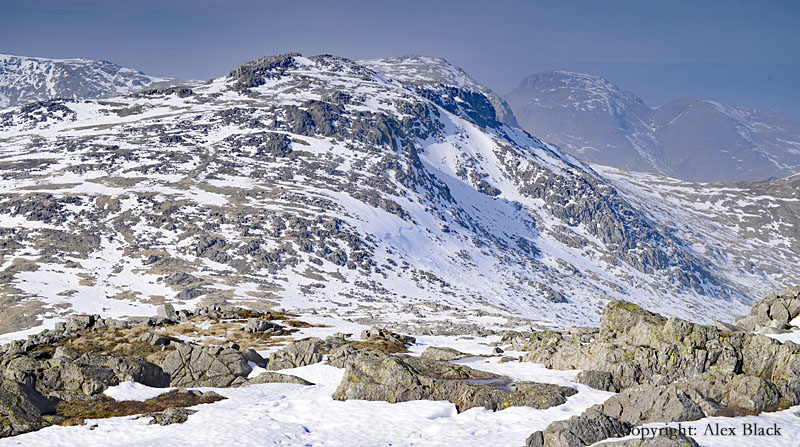
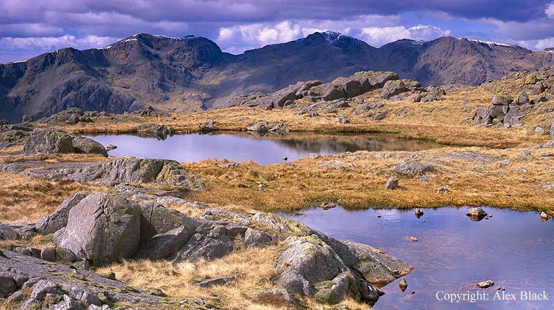
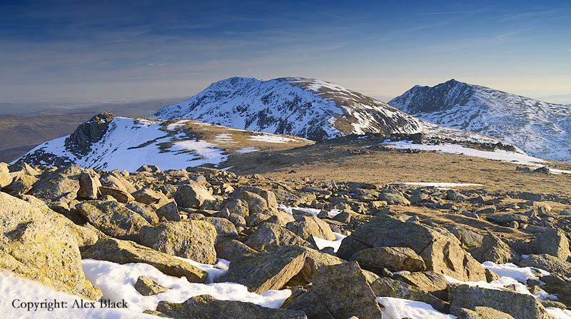
The next highest fell on the ridge of the Scafells is Great End (910m) which is at the north end of the main ridge. Great End is Lakeland’s fifth highest fells, and the name is well-earned; less than 100m from the summit the fell falls away steeply in a jumble of crags, scree and gullies for almost 300m. This is a wonderful vantage-point, the northern half of the panorama is almost as good as the view from the Scafells, and in fact the view north down into Borrowdale is superb, with a bird’s-eye view down on Sprinkling Tarn.
Below Great End is Seathwaite Fell (601m) which is the tail-end of the Scafell ridge. This is a fell with many little summits, sprinkled with tarns, very different from Scafell and Scafell Pike, but a lovely place in its own way, and worth exploring if the weather proves to be too bad for Scafell Pike.
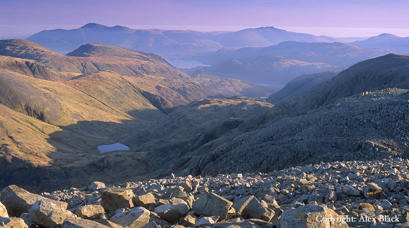
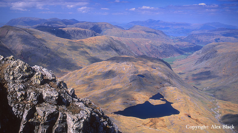
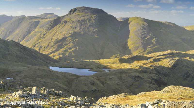
From Great End high ground continues east, curving around the head of Eskdale, forming the grandest horseshoe in the Lakeland Fells. The fells on this ridge are all rough and rocky under foot, continuing the mountainous scenery. Esk Pike (885m) is the next fell east of Great End, and is the eleventh highest Wainwright fell. It stands at the head of Eskdale and is connected to Great End by the high mountain pass of Esk Hause (750m approx.).
The summit is a very pleasant rocky ridge running NW to SE for about 1.2km to Ore Gap (775m approx.). Wainwright says much in praise of the view, but I have always found it rather disappointing, except for the view down into Eskdale. If Esk Pike stood alone it would probably be a favourite for many walkers, but it is overshadowed by higher fells, none of which are seen at their best. Its best feature is its south ridge running down into Eskdale which is a wonderful wild walk, and one of the best places to see the eastern crags of Scafell Pike.

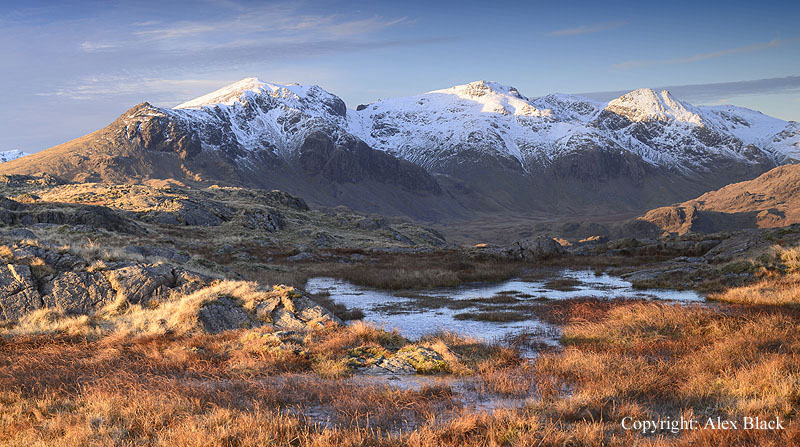
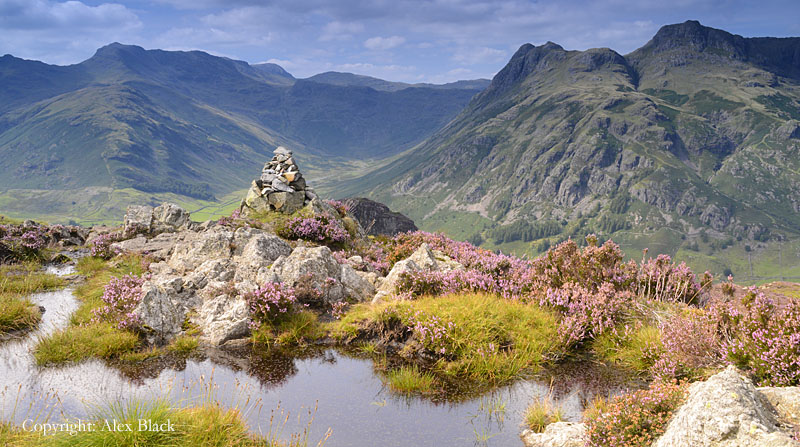
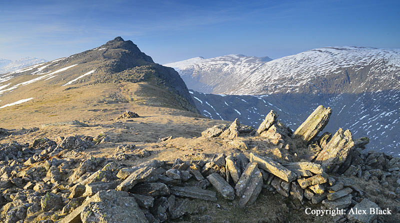
Across Ore Gap, Esk Pike connects with Bow Fell (901m), the sixth highest Wainwright. Bow Fell is recognisable in most views, not just because of its height, but it has something close to true mountain form and is crowned by a distinctive, neat peak. Bow Fell has a great position at the head of Langdale and has a fine view down that valley to Windermere.
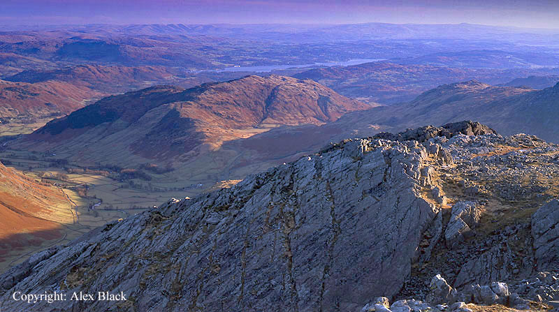
In fact the view is good in almost every direction; the view across Eskdale to Scafell and Scafell Pike is particularly impressive.
The summit itself is a huge pile of boulders, a sort of natural cairn, set on the western side of a 100m-wide strip of rocky ground which extends north to a lower summit, Hanging Knotts; there is a good view from here down into the Langstrath Valley, with Angle Tarn directly below.
There are crags around Bow Fell’s summit in most directions, most famous of which are to the south, Bowfell Links with is distinctive series of parallel gullies. The crags east of the summit are also impressive and can be reached without too much difficulty by a diversion near the top The Band; The Band is the main route up from Langdale, see Wainwright for full details of routes.

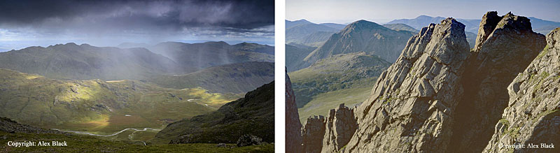
South of Bow Fell is Crinkle Crags (859m) seventeenth highest Wainwright fell, and one of his favourites. Crinkle Crags is a rocky ridge approximately 1.5km long, it is not narrow at any point, but is very rough in parts with many twists and turns, and with five distinctive summits on the main ridge; Wainwright described it as “Lakeland’s best ridge-mile”.

Although slightly lower than Bow Fell, the view is just as good, and in fact Bow Fell adds much to the view. High ground continues at the south end of Crinkle Crags, dividing into three; the true south ridge of Crinkle Crags goes over Stonesty Pike to Little Stand before descending steeply into the head of the Duddon Valley. Being a dead-end ridge this is a quiet spot, but the rocks and tarn on Little Stand make this a very nice place.
East of Little Stand and occupying its own ridge above the Wrynose Pass is Cold Pike (701m). This is a separate Wainwright fell with a fine rocky summit and nice views in many directions, but its neighbours seem to get all the attention.

To the east of Cold Pike, just across Red Tarn, is Pike of Blisco (705m) which has a much better position overlooking the head of Great Langdale. From here Pike of Blisco appears as a fine summit in its own right, almost as tempting as Crinkle Crags and Bow Fell; in fact it is possible to walk all three fells in one day, perhaps taking in Esk Pike too. Pike of Blisco’s summit is not the neat peak as the view from Langdale suggests, but is a rocky double-summit of flat crags, which is no less interesting, but the views from here are excellent, particularly over Langdale and the Langdale Pikes.
Below its summit, a long shoulder extends down towards Little Langdale ending above Blea Tarn at Blake Rigg; there are many interesting little tarns and summits to be explored here, as well as views of Langdale and Windermere.
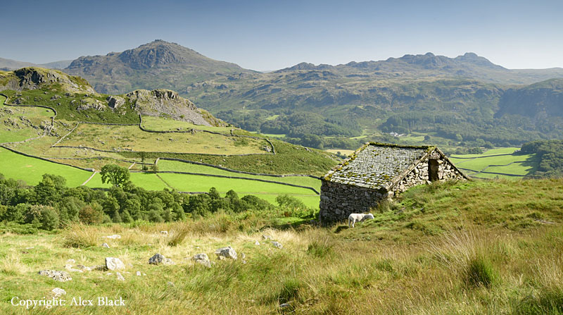
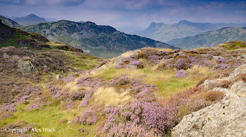
Across from Blea Tarn is Lingmoor Fell (469m). This is the last fell on this corner of the Southern Fells, and takes the form of a ridge separting Great Langdale from Little Langdale. Although one of the lowest of the Southern Fells, Lingmoor Fell is well worth a visit as this position gives it some of the best views of the head of Langdale; this is almost the perfect viewpoint for Bow Fell and the Langdale Pikes, particularly when the heather is out in late summer.
Besides Seathwaite Fell which has previously been mentioned, the Southern Fells have a significant presence in Borrowdale. A ridge rises north of Esk Hause on which there are three more fells, the first in this ridge is Allen Crags (785m) which is a rugged dome of rock. Being hemmed-in by higher fells, this is not the best viewpoint but there are glimpses of Derwent Water, Borrowdale and Windermere, and a striking view of Bow Fell.

Running north from Allen Crags there is a wide rambling ridge, dotted with tarns, descending and rising to Glaramara (783m). Glaramara dominates the upper Borrowdale valley and has the most striking view of Derwent Water and Skiddaw seen through the “Jaws of Borrowdale”.

There is also an unusual view of the Langdale Pikes. Glaramara sends two sprawling ridges down into Borrowdale; the westerly one is Thorneythwaite Fell which has the main route up the fell from Seatoller.

The eastern ridge is longer and higher, and runs down to Rosthwaite Fell (540m approx.). There are many summits on this ridge, the most prominent is Rosthwaite Cam which almost appears to be a huge hanging boulder when seen from below at Seatoller.
However, the point Wainwright takes as the summit is further north, and is named Bessyboot: this is the most northerly point of the Southern Fells

Wainwright’s Southern Fells also includes a pair of fells known to everyone who visits Wast Water; this is The Screes which plunges directly into the lake.
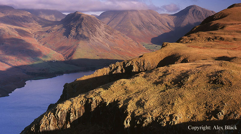
The fells that make up The Screes are Illgill Head (609m) at the north-east and Whin Rigg (535m) to the south-west. The top of The Screes and its southern flank are a striking contrast being almost entirely grassy except for Whin Rigg, where the crags of The Screes reach up almost to the summit. The views down The Screes to the lake are dizzying in places, and Illgill Head has a grand view of Wasdale Head.

Between the Scafells and the ridge of Bow Fell, a lower ridge rises from the upper Eskdale valley, which has three Wainwright fells on it, from north to south they are: Hard Knott, Harter Fell and Green Crag.

Hard Knott (549m) is mainly known for the steep, twisting road which crosses its southern end, and for the Roman fort on the Eskdale side of the Pass, but the fell itself is one of the best vantage points for the fells around the head of Eskdale, and the Scafells in particular.
Hard Knott is a ridge about 1.5km long (1 mile approx.) with three rocky summits running along it. There is parking for just a couple of cars at the top of the pass, and the first of these summits, Border End can be reached fairly easily from here, with the main summit less than 1km further on.

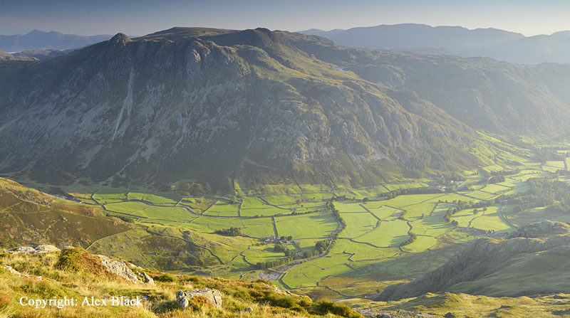
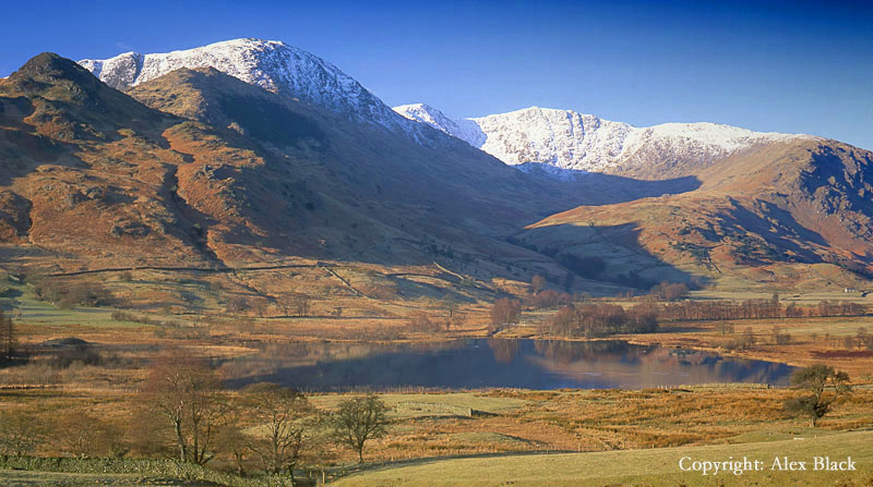
South of the Hardknott Pass is Harter Fell (653m). Harter Fell is the highest point on the long ridge between Eskdale and the Duddon valley, which extends all the way down to Black Combe on the coast. The Duddon side of Harter Fell is heavily wooded, but there are lovely up routes up from Eskdale. The summit is one of the most distinctive in Lakeland; the highest 300m is a rough pyramid crowned by a group of rocky tors.
South-west of Harter Fell a series of rocky summits rise from the moorland above Eskdale. This is Green Crag (489m), the last Wainwright fell on this ridge. Like Harter Fell, there are lovely routes of ascent from Eskdale, and its various summits are worth exploring; Crook Crag and The Pike.
The Coniston Fells

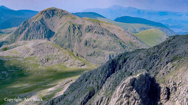
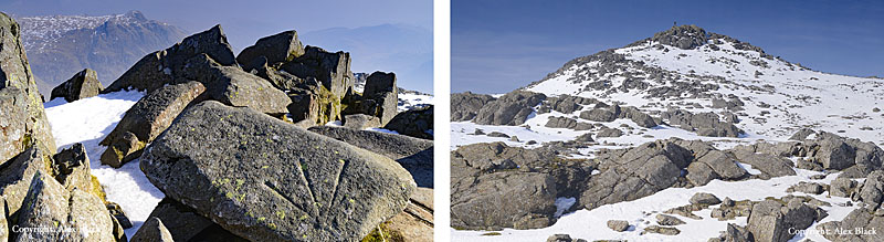
South of Wrynose Pass are the Coniston Fells. The highest of these are a neat group of seven fells of similar height, all closely connected on a single system of ridges. The highest and most famous is The Old Man of Coniston (803m), or as Wainwright names it: Coniston Old Man. The “old man” in the name comes down from one of Cumbria’s ancient tribes and is linked to the Welsh “allt maen” meaning high rocks. And rocks have been important to Coniston as this is one of the most mined areas in the Lakes; for Coniston this was principally slate and copper. The main route up The Old Man from Coniston passes both of these types of workings, adding a different source of interest to the walk. The Old Man of Coniston is also famous for having previously been the highest point in Lancashire before the reorganisation of the counties in 1974.

Perhaps as befitting this status, the summit is crowned with a viewing platform which bears the cairn, with the trig-point alongside. Being at the southern end of the Lakeland fells, the southern half of the view is almost entirely of lakes and the coast around Morcambe Bay; Blackpool Tower is a landmark on clear days. The Lakeland fells are all grouped into the northern half of the panorama, which manages to include every area, with Skiddaw in the Northern Fells making a surprise appearance at almost due north. The Scafells are well seen to the north-west, but it is probably the cliffs of Dow Crag which will draw most attention.
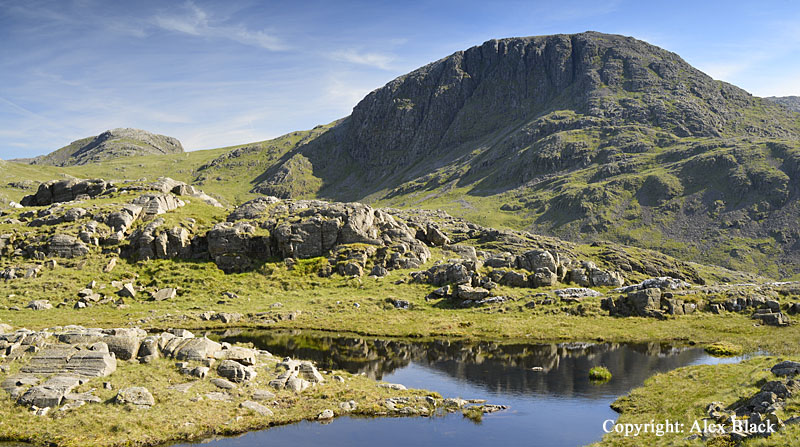
Dow Crag (778m) is due west of The Old Man of Coniston and is one of Lakeland’s finest fells. Being tucked-in behind The Old Man, it is often hidden from view, and is best appreciated close up. The summit is rocky ridge rising to a distinct top, perched above sheer cliffs of 150m with Goat’s Water sitting below a scree slope; from above or below, this is an impressive place.
Dow Crag sends a long ridge southwards, stretching almost to the Duddon Estuary, but after about 1km from the summit it is crossed by the Walna Scar track coming up from Coniston, this gives a route with easy gradients to one of the most spectacular fells.

The main spine of the Coniston Fells runs north from The Old Man, first to Brim Fell (796m) which has a fine “bee hive” cairn on the summit.

Continuing north, the ridge then descends and narrows to Levers Hawes, then rises to Swirl How (800m approx.) the second highest of the Coniston Fells.
Approached from this direction, Swirl How is a wide, stony ridge with crags on the right (east), leading up to an attractive summit cairn which is perched on cliffs above the deep hollow of Greenburn. This is probably the best location on the Coniston Fells for views across the Lakeland fells which almost seem to be set out in order across the northern half of the panorama.
Following the rim of crags to the west then north brings you to Great Carrs (780m approx.). This is also an attractive summit, and as the most northerly of the Coniston Fells there are still excellent views north across the fells.
However, Wainwright says that the best views of Scafell and Scafell Pike are to be found 1.2km west where a wide grassy depression connects to Grey Friar (770m approx.). This is the most westerly of the Coniston Fells and almost seems to peep into upper Eskdale. The summit is mostly grassy, but there are a few interesting rocky outcrops which add to the view.
East of Swirl How a rocky ridge named Prison Band leads down to Wetherlam (762m). This is the lowest of the Coniston Fells but still has good views; Windermere and Coniston are visible along with many tarns; this is also the best view-point down into Little Langdale.

Wetherlam sprawls across a substantial area between Coniston and Little Langdale, with several lower summits worth exploring, such as Birk Fell and the Yewdale Fells. The best place to start is Tilberthwaite, where the slate workings are also worth seeing.

East of Wetherlam Wainwright included two lower fells; the first Holme Fell (317m) stands between Tilberthwaite and the A593 Coniston-Ambleside road. Although of very modest height, it has a rambling, craggy summit, particularly attractive when the heather is out.
Just across the A593 is Black Fell (322m). This is a low, rambling fell covering a considerable area south of Skelwith. There is woodland on most of the lower slopes but the top of the fell opens out to rolling moorland, dotted with larches. The summit, named Black Crag, feels a long way from the high fells but gives good views across much of the South Lakes, with the fells of Langdale being the most dramatic part.
