Skiddaw and Blencathra
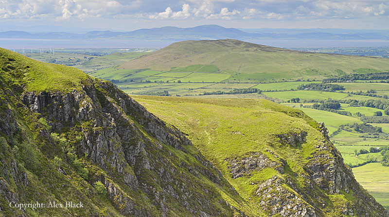
This area of fells rises directly above Keswick and Threlkeld and stretches north for 13km (8 miles) almost to Caldbeck and Hesket Newmarket and covers a similar distance east to west. The Northern Fells are a more clearly defined area than any of Wainwright’s other groups of fells, having no high ground or ridges connecting to other groups; in fact, seen on the Ordnance Survey’s Landranger map, The Northern Fells appear as a roughly circular area of high ground. Within this rough circle, there are 24 Wainwright fells which are divided into three groups; starting in the south-west with the fells above Keswick, this is the Skiddaw group of fells.
Skiddaw
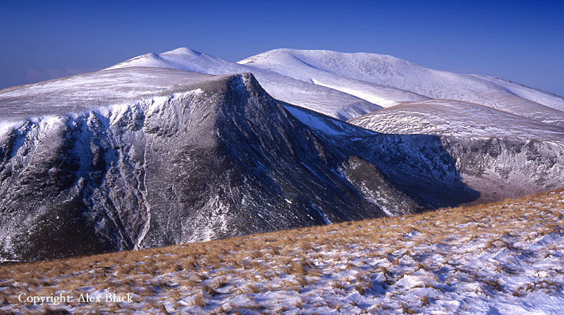
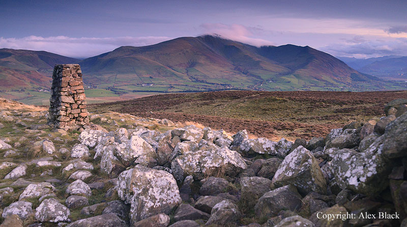
Skiddaw (931m) has pride of place amongst the Northern Fells, being England’s fourth highest mountain, overtopping all else for 16km (10 miles). Compared to the other 3,000 footers (Scafell Pike, Scafell and Helvellyn), Skiddaw is by far the easiest to climb; the route up from Keswick has been in use for more than 200 years, with those early visitors being taken up on horseback. There are no dangerous crags to negotiate on this route, it is simply a long up-hill walk (9km or 5.5 miles each way). The route can be made even shorter by parking at the top of Gale Road above Applethwaite. However this has given Skiddaw the reputation of being rather dull. As Wainwright points out, this is unfair as there is more to Skiddaw than is usually seen on this route.
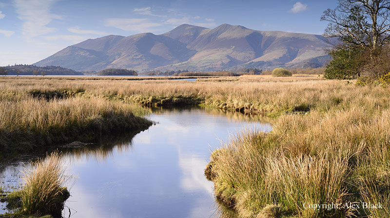
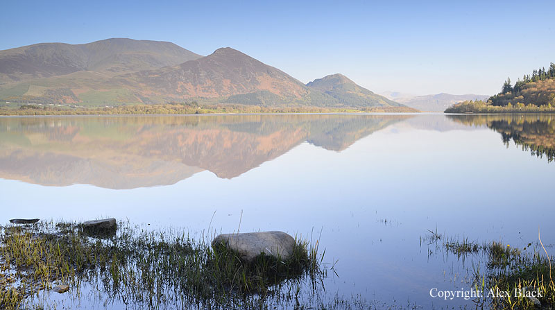
The summit is an undulating ridge about 500m long, wide on top, but quickly steepening on the sides, particularly on the western flank, with the highest point towards is north end of the ridge. This is an excellent, aerial vantage point with the best of the views being from the south end of the summit ridge; the view down over Derwent Water is stunning.

It is unusual to have such a good view of one of the larger lakes from one of the highest fells (Wast Water from Great Gable being the other famous example) and here the view is backed by a wonderful panorama of Lakeland’s highest fells.

Just before reaching the summit, the main route up from Keswick passes Skiddaw Little Man (865m); in fact this is perhaps the one trap on this route as the lower summit hides Skiddaw itself on the approach over Jenkin Hill. However, an unintended diversion to Little Man is no great loss as it involves very little extra effort, also the summit is possibly nicer than Skiddaw’s, and the view of Derwent Water just as good. There are a few more crags to be seen here and the view towards Skiddaw makes it look more like a mountain than from anywhere else on this route.
The other fell often passed by on the main route from Keswick is Lonscale Fell (715m) which is at the eastern end of the Skiddaw group of fells. The summit is easily reached by following the fence from Jenkin Hill, but here too, the fell manages to hide its best features; below the eastern summit the fell suddenly falls away in a spectacular tumble of crags and scree. This is Lonscale Crags which stretch for over 1km along Glenderaterra Beck. A close-up visit to the crags is fairly easy as the Cumbria Way passes along the crags on its way to Skiddaw House, and is an easy walk from Gale Road.
From the south Skiddaw appears to be little more than a huge hill; it is really from the north that it has some mountain features, and the northern routes are the more interesting ascents; best of all is Longside Edge.
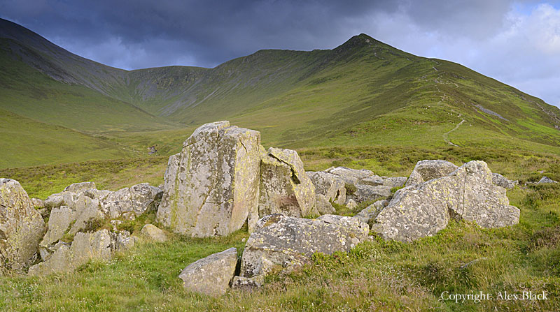
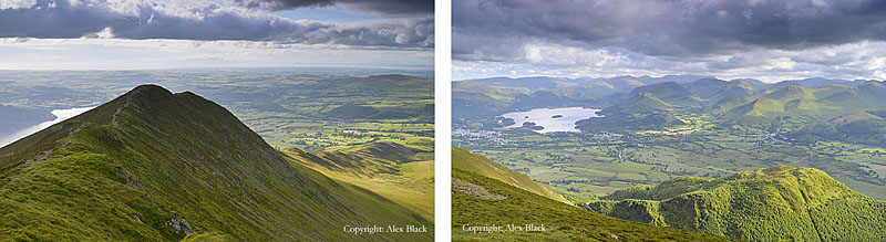
Starting at High Side which is just off the A591 near Bassenthwaite Village, a path leads through fields to the foot of the ridge at Watches; although this is a natural outcrop of rocks and boulders, it has the appearance of an old, abandoned quarry. From here the route ahead is clear, with the first summit rising as a neat peak; this Ullock Pike (690m approx.). The last 100m of ascent is steep and rough, the ridge is nowhere narrow, and the summit is an excellent viewpoint over Bassenthwaite.
From Ullock Pike the ridge is clearly defined, bearing south-east. This is Longside Edge; although the ridge drops away steeply to the north there are no narrow sections here, and this is the best bit walk, particularly when the heather is out. After just 500m is the summit of Long Side (743m); sadly the ridge widens here, but the views south over Derwent Water start to open out.
Long Side almost merges into the next fell Carl Side (746m) which has a wide flat top, buttressed up against Skiddaw. The main path on the fell skirts around the head of Southerndale, missing the summit by 200m, although there is fine view of Derwent Water from just south of the cairn. Carl Side is almost completely overlooked by Skiddaw, which appears to be a huge mound of slate from here; Skiddaw is nearly 200m higher than Carl Side and the path up through the screes is uninviting but safe.
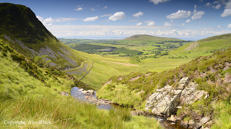
A longer, gentler but wilder route up Skiddaw starts from the north at the Dash Valley. There is parking just south of Peter House Farm, and from there a track leads up the valley to the waterfalls; Whitewater Dash. The water here tumbles down a steep ravine, and although it’s not easy to get close up, it is an impressive sight.

The track goes past the top of the falls, heading for Skiddaw House; it is worth carrying on along the track for about 500m to get a view of the open moorland around lonely Skiddaw House, but the route for Skiddaw turns right at the top of the falls, following a fence up Birkett Edge. This is the steepest part of this route, but there are excellent views here over the Dash valley and of Dead Crags.
The fence leads up onto the Wainwright summit of Bakestall (673m); Skiddaw hides most of the view to the south, but this is an attractive summit with good views of the Northern Fells. The route for Skiddaw follows the fence for about 1km onto the top of Broad End from where a path leads up to the summit of Skiddaw. It is possible to use this route together with the Longside Edge route (one in ascent, one in descent) to complete an excellent day-walk over Skiddaw.
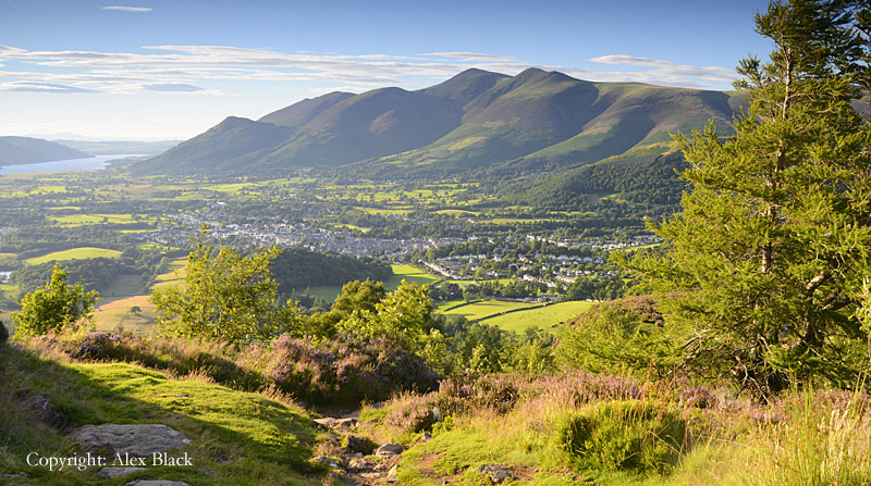
The lowest member of the Skiddaw group of fells is the much-loved Latrigg (351m), which rises directly north of Keswick. This lovely little hill boasts wonderful views for very little effort, especially if the Gale Road carpark is used.
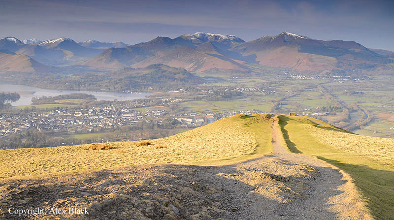
The summit is mostly grassy with a bench to help visitors take in the view, which is wide-ranging; from the Helvellyn range in the south-east, across Walla Crag and Bleaberry Fell of the Central Fells, to Derwent Water and Keswick in the south, backed by the Borrowdale Fells, then Catbells and the Newlands Fells, to Grisedale Pike in the west, then Whinlatter and Bassenthwaite Lake.
Blencathra
The south-eastern third of the Northern Fells is grouped around Blencathra (868m). Blencathra rises directly above the village of Threlkeld and is one of Lakeland’s most recognisable fells: the distinctive crags and gullies of its southern face, topped by its pointed summit, mark it out in any view.

From the east it has the added feature of a double summit with a saddle between, giving the fell its alternative name, Saddleback.

Blencathra is good to look at and good to walk on, making it one of Lakeland’s best-loved fells; it was one of Wainwright’s favourites and he devoted more pages to Blencathra than any other fell. One reason for this is the number of routes of ascent, and there is a wide choice from easy to very difficult. The easiest is from Scales on the A66, over the subsidiary summits of Scales Fell and Doddick Fell. However my favourite route is from Threlkeld or the Blencathra Centre ascending over Blease Fell which is the broad, grassy western flank of Blencathra.
There are no crags here, but this is a very dull route, until the top of Blease Fell is reached; at this point you start to get the amazing views down the crags and ridges of Blencathra’s south face.

The path itself continues safely to the summit because to the north the fell falls away gently as grassy moorland. The route up from Scales on the A66 is similar, being on grass or a well-laid path most of the way, except for the last section which is rougher. The best route up from Threlkeld is by Hall’s Fell Ridge; Hall’s Fell rises just east of Threlkeld as a buttress to Blencathra, and is connected to the summit by a rocky ridge. Hall’s Fell Ridge is the easiest of Lakeland’s four famous narrow ridges (the others being Striding Edge, Swirral Edge and Sharp Edge) as it is the widest, so there is always an easy way around any tricky sections.

The most challenging route of ascent is by Sharp Edge. This is the narrowest of Lakeland’s four ridges, and therefore the most difficult, and does not seem to be a route Wainwright was fond of. Sharp Edge is tucked away at the back of Blencathra, below its saddle; walkers usually start from Scales and head for Scales Tarn. Once the outlet of the tarn has been crossed, the rising ground slowly narrows to the ridge. The south side of the ridge is relatively smooth, but there are rough paths on the north side below the crest which give much easier footholds. However, about three-quarters of the way along the ridge there is a “bad step” where the ridge narrows and a gap must be scrambled across. The final section is a scramble up steep rocks to eventually arrive on the safe ground of the saddle. Blencathra’s summit is a little rocky rise with excellent views in most directions; for me the most interesting part of the view is looking south-west towards Derwent Water.
There are four other fells in Blencathra’s group: Bowscale Fell, Bannerdale Crags, Mungrisedale Common and Souther Fell. For anyone wanting a quieter route up Blencathra, it is possible to start from the east at Mungrisdale, and go over Bowscale Fell (702m) or Bannerdale Crags (683m) and from there ascend Blencathra’s north ridge. Souther Fell (522m) is also at the eastern end of Blencathra; this is an almost featureless grassy ridge, but does have a good view of Blencathra’ s eastern crags. Mungrisedale Common (633m) is little more than a slight rise on the vast north-western flank of Blencathra, on its way down to the River Caldew in Skiddaw Forest.
The Uldale and Caldbeck Fells

The northern third of the Northern Fells are the Uldale and Caldbeck Fells, where there are nine Wainwright fells. The highest of these is Knott (710m) which is located almost perfectly in the centre of the group with ridges connecting to the other fells. This is an attractive group of fells where the gradients are generally quite gentle; they are mostly grassy, although some of the ridges are boggy, there is heather in many places, with rocky outcrops on some of the summits. This is one of the quietest areas of Lakeland, perhaps because the views are rather limited; being behind the higher fells of Skiddaw and Blencathra, it is only really the gap between Blease Fell and Lonscale Fell that lets you see further into the Lakes.

Perhaps the most famous fell in this area is Carrock Fell (661m) which is at the eastern end of the group above Mosedale. This is rockier than its neighbours and is famous for the hillfort on its summit, the rocks of its wall can still be clearly seen.
One outlier of the Northern Fells is Binsey (447m) which stands north of Bassenthwaite. This rounded hill can be climbed from several directions, perhaps the simplest is from the A591 just north of Bewaldeth where a track across fields gives access to the open fell. The summit is a short, rocky ridge, rising from the heather moorland; there is a distant view of the Borrowdale and Newlands fells, but there is also a fine view of Skiddaw.